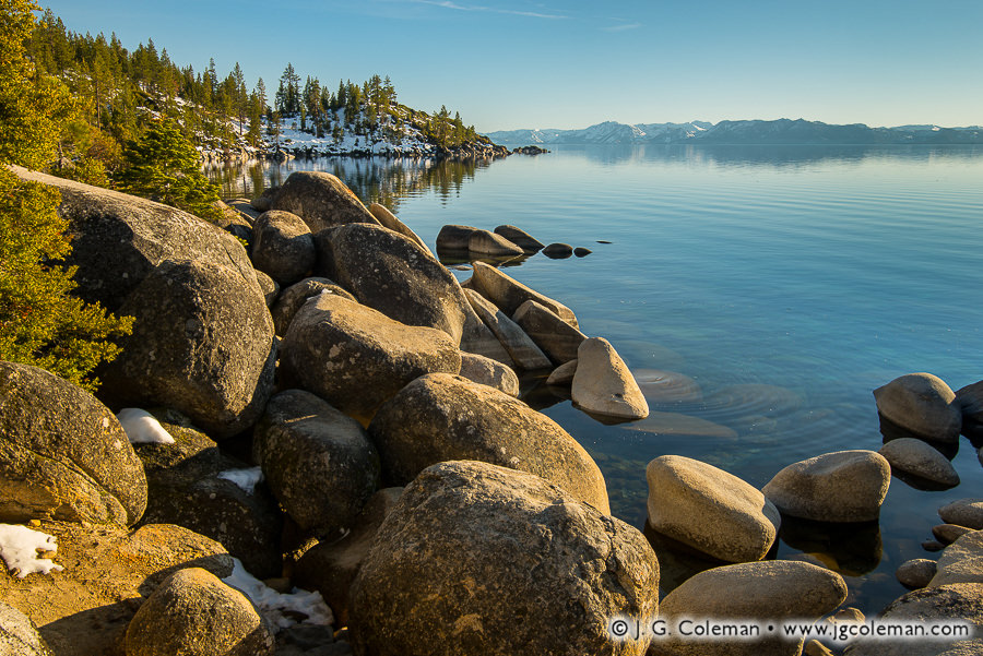
Memorial Point on Lake Tahoe, Incline Village, Nevada
Snowy evergreen forests and jumbles of massive boulders meet with the placid waters of Lake Tahoe at Nevada’s Memorial Point. Dreamy, snow-capped mountains loom on the far shore, their precipitous slopes and jagged profiles plainly visible even at a distance of 20 miles.
For somebody such as myself, born and raised in Connecticut, the vast panorama of open water and mountain scenery offered by Lake Tahoe is truly otherworldly and enchanting. If the scenery isn’t amazing enough, it’s also numerically impressive on several metrics. At an elevation of more than 6,000 feet and with a surface area of 190 square miles, there is no other alpine lake so large in the entire nation. And remarkably, Lake Tahoe’s greatest depth approaches 1/3 of a mile, making it the second deepest lake in the country (just behind Crater Lake at 1,900 feet deep).
New Englanders accustomed to seeing their local lakes vanish beneath sheets of ice each year will surely be interested to discover that Lake Tahoe doesn’t freeze over, despite temperatures reminiscent of Northeastern winters and an average snowfall of 125 inches each season. How is that possible? Well, it’s complicated actually, but the abridged explanation is that the lake’s extreme depths help it to retain the heat stored up in its waters over the warmer months. Even in the coldest of winters, the main body of Lake Tahoe rarely ever drops lower than 40° F.
Purchase a Fine Art Print or Inquire About Licensing
Click here to visit my landing page for “Memorial Vista” to buy a beautiful fine art print or inquire about licensing this image.
Want to See More?
Be sure to check out some of my other work from Nevada and California.